Subsurface Utility Mapping
Mapping the Past to Build the Future

Why Mapping?
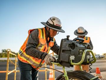
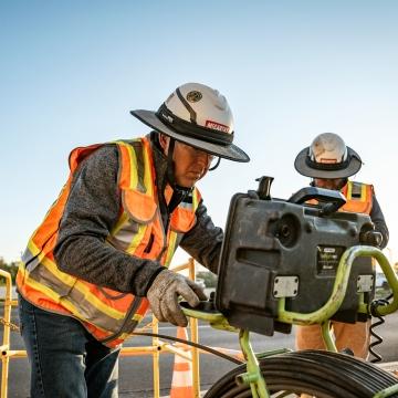
The risk of unknown subsurface utilities and other underground hazards affects every construction project and requires proactive efforts to mitigate. McCarthy’s Subsurface Utility Mapping (SUM) experts address these risks well before work begins and then continue throughout the project life cycle.
The result? Safer project sites, improved constructability, reduced risk of community impact, and greater cost and schedule certainty.
The Power of an Integrated Partner
The key to mitigating underground risks lies in reliable data and continuous communication throughout the project lifecycle. By integrating SUM as a project partner, rather than a transactional service, stakeholders align around a single source of truth, ensuring seamless data implementation and zero information loss.
Map
Discover, develop and execute a SUM scope and approach that aligns with the needs of all project facility stakeholders.
Design
Utilize all aspects of the deliverable package to support, enhance and further develop designs that improve both cost and schedule certainty.
Coordinate
Engage directly with the project team to provide clarity of the 3D civil informational models supporting the overall coordination of construction operations.
Layout
Work alongside the project layout team to provide necessary data to accurately show existing and proposed utility alignments on site.
Build
Ensure the utility model and supporting data are available and understood by all field personnel before executing critical operational tasks.
Operate
Utilize subsurface utility engineering data and as-built information to update current utility database and integrate all FM operations including repairs, maintenance, budgeting, emergency response and operational support.
Project Life Cycle Integration
Aligning all project stakeholders ensures all data is understood, implemented, and communicated with zero loss of information across the total project life cycle.
We'll stakeholders around a single source of truth and develop preliminary cost, schedule, and scope certainty. This supports master planning and future PD&C decisions, maximize land use, and address utility needs and easements early to enable greater clarity in design planning.
Aligning stakeholders around a single source of truth reduces safety incidents, utility strikes, change orders, re-designs, schedule delays, and claims. This approach helps avoid costly emergency repairs and ensures a continuous flow of work.
Align stakeholders around a single source of truth to enhance collaboration and decision-making. A confident emergency response plan will be developed, aiding predictability in maintenance and repair budgets. This approach reduces the negative impact on customers during maintenance operations and provide living information to support future BIM and project needs.

Our Work in Action
Saint Louis University (SLU) partnered with us to address the challenges of their 200+ year-old campus and minimal utility records during campus-wide master planning. Together, we developed a comprehensive plan to understand subsurface infrastructure, laying the foundation for future milestones like space planning, conceptual design, and financial outlooks. For over a decade, McCarthy has supported SLU through every phase of their campus life cycle, delivering critical insights, impactful data, and tailored solutions.
Deliverable Package
McCarthy’s SUM team utilizes a wide range of technology to provide an accurate and reliable deliverable package and minimize the underground risk for clients.

2D Utility Exhibit

Cloud Hosted GIS

3D Utility Model

Butterfly Diagram

Augmented Reality
Our Clients
The use of McCarthy mapping and 3D scanning helped us find our problem areas and identify major conflicts within the design very early, which eliminated going back and doing redesign on certain areas.
Architect, SmithGroup